
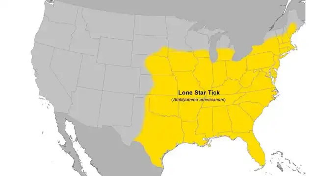

The CDC’s lone star tick map covers most of the eastern half of the United States. The shaded range runs from central Texas and Florida north through the Midwest, then up the East Coast into New England. Virginia, Maryland, and Washington, DC sit right in the middle of it, so if you live in the DMV, lone star ticks are a local tick.
I work in our family’s pest control business, and ticks come up with homeowners all season. Because this topic touches on health, I’m sticking to what the CDC, state health departments, and published researchers say. I’ll also point out what the map can’t tell you, because that part matters just as much.
The CDC Lone Star Tick Map
The CDC publishes an estimated range map for each major tick in the U.S. On its Where Ticks Live page, the agency describes the lone star tick as “widely distributed in the Northeast, South, and Midwest.” The page was last updated in July 2025.
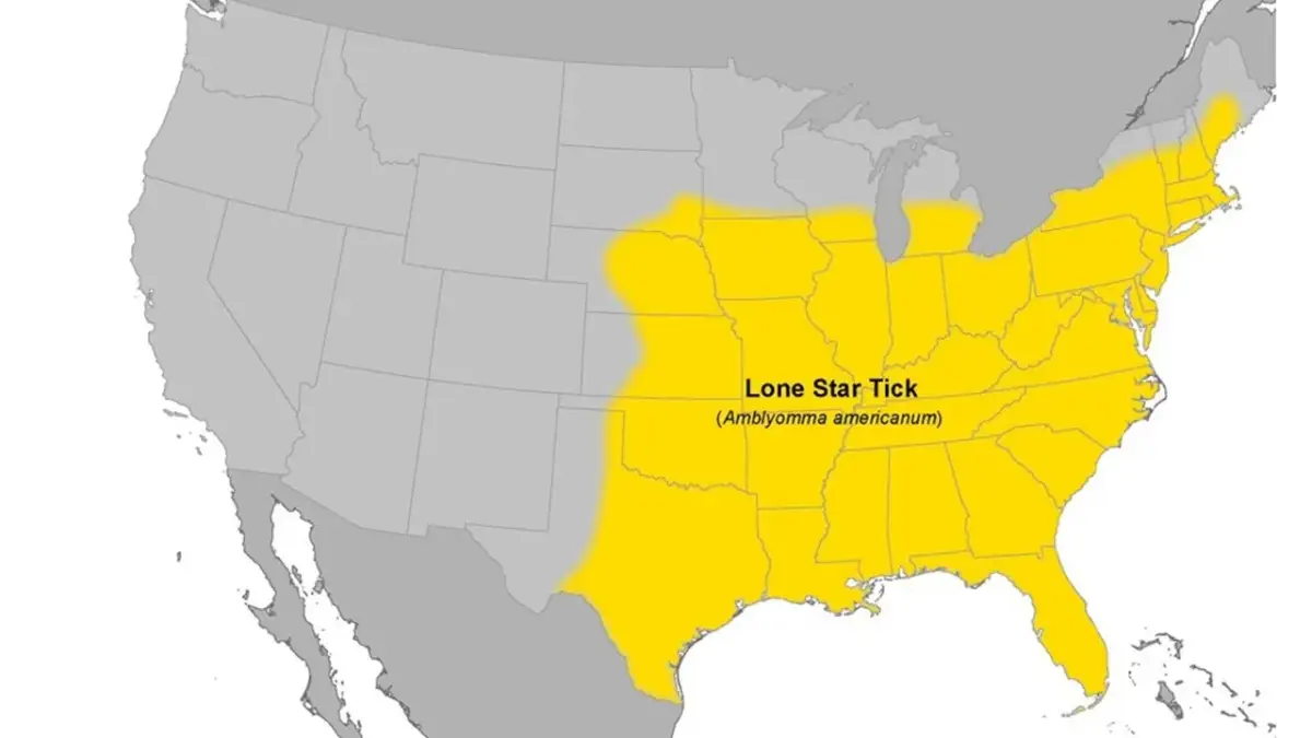
Here’s how to read the shaded area on that map:
- Western edge: central Texas, then north through Oklahoma, Kansas, and eastern Nebraska.
- Northern edge: across Iowa and Illinois, into southern Michigan, then east through New York.
- Northeast: most of New England, reaching into southern Maine.
- South and East: the whole Gulf Coast, Florida, and the Atlantic states, including all of Virginia, Maryland, and DC.
Basically, if you live east of the Great Plains and south of the upper Great Lakes, you’re inside the lone star tick range.
What the Map Doesn’t Show
The CDC map is a range map, not a risk map. The CDC notes that populations of ticks “may be found outside shaded areas.” It also says a tick being present doesn’t necessarily mean it spreads a specific disease there.
Additionally, the shading is even, but tick numbers are not. One wooded neighborhood can be loaded with lone star ticks while a nearby subdivision with open lawns sees very few. The map tells you the tick lives in your region. It can’t tell you how many are in your backyard.
How the Lone Star Tick Range Has Spread North
Lone star ticks didn’t always reach this far north. According to a 2018 scientific review by tick researcher Daniel Sonenshine, the old northern limit was roughly the Ohio River valley, stretching northeast into southern New Jersey.
That’s changed. The same review says established populations now reach as far north as Michigan, almost all of New York state, and most counties in New England. It also lists the western spread into Nebraska and South Dakota. The author calls the northward expansion “consistent with climate change” and flags the northeastern U.S. and southern Canada as areas at risk.
The most detailed national map comes from a 2014 county-level study in the Journal of Medical Entomology. Researchers pulled together 18,121 collection records from 1898 to 2012. They found lone star ticks recorded in 1,300 counties across 39 states plus DC.
A few details stand out for our area:
- Virginia had more records than any other state (3,881). Maryland came second (1,692). DC had 12.
- The Mid-Atlantic region held 31% of all records in the study.
- 653 counties met the bar for an “established” population.
The authors were careful about the northward trend. Their decade-by-decade maps suggested a shift north, but they wrote that “more definitive evidence is needed to confirm such a shift.” They pointed to regrowing forests and rising white-tailed deer numbers. In some areas, the tick may be reclaiming range it held in the past.
So, what’s driving the spread? Researchers point to three things working together:
- More deer. White-tailed deer are a major host for adult lone star ticks. Deer numbers have grown across the East.
- More forest. Old farmland has grown back into woods, which gives ticks shade and humidity.
- Warmer weather. Milder winters may let ticks survive farther north than before.
Lone Star Ticks in Virginia, Maryland, and DC
If you live in our service area, you don’t need a map to know lone star ticks are around. Here’s what each local health agency says.
| Area | What officials say | Source |
|---|---|---|
| Virginia | Found throughout the state, usually below 1,600 feet in elevation. Common in the coastal and Piedmont regions. | Virginia Department of Health |
| Virginia | The most common tick to bite people in Virginia. | VDH ehrlichiosis fact sheet |
| Maryland | One of the three ticks that most commonly bite people in the state. | Maryland Department of Health |
| Washington, DC | Listed in DC’s tick ID guide, most active in spring and summer. | DC Health |
Virginia
The Virginia Department of Health says the lone star tick “can be found throughout Virginia but usually lives in areas below 1,600 ft. in elevation.” That elevation line matters. Most of Northern Virginia sits well below it, so the tick is at home in our suburbs.
Virginia Tech Extension adds that the lone star tick “can be very common in the Piedmont and Coastal Plain regions.” Additionally, VDH’s ehrlichiosis fact sheet calls it the most common tick to bite people in Virginia. For a full rundown of every species, see my guide to ticks in Virginia.
Maryland
The Maryland Department of Health lists the lone star tick with the blacklegged tick and the American dog tick as the ticks that most commonly bite people in the state. If you live in Southern Maryland, our La Plata mosquito control page covers how we handle yard pests in that area. I go deeper on the state in ticks in Maryland.
Washington, DC
DC is small and built up, but it still has parks, stream valleys, and wooded edges. DC Health includes the lone star tick in its tick ID guide. It lists the tick as most active in spring and summer, with white-tailed deer and wild turkeys as its main hosts.

Where Lone Star Ticks Live on Your Property
A range map works at the state level. Your yard works at the level of a shady flower bed. So it helps to know where these ticks actually hang out.
A 2026 Virginia study that tracked lone star ticks from 2009 to 2018 found that “wooded habitats consistently supported higher tick abundance than grassy areas.” VDH also notes they live in leaf litter on the forest floor and in partly shaded grass.
In practice, that points to a few spots around a typical DMV home:
- The woods line, where your lawn meets trees or brush
- Leaf litter under shrubs and along fences
- Overgrown beds and tall grass at the edges of the yard
- Deer paths and spots where wildlife bed down
Daren, one of our registered technicians, sees the same pattern on his routes. He says ticks can be anywhere you have grass, but they gather in shaded areas, thick brush, overgrown bushes, low tree limbs, tall grass, and leaf litter. In his words, keeping the yard maintained and the grass low “helps a lot more than they realize.”
Ticks are often a field and forest problem more than a mowed-lawn problem. On a road trip once, I had to pull over and step into a field for a minute. When I walked back out, I had four ticks on my leg.
That’s what the habitat research shows, too. The tall, unmowed spots are where ticks wait. So when we look at a property, we start at the edges: the tree line, the brush, and the leaf piles that never get cleared.
When Lone Star Ticks Are Active Here
In the DMV, lone star ticks are a warm-season pest with a long run. The Virginia study above broke down the peaks by life stage.
VDH says adults can be active from late winter. On warm days, the first ones start looking for hosts.
Adults peak. The Virginia study found adult numbers were highest in late spring to early summer.
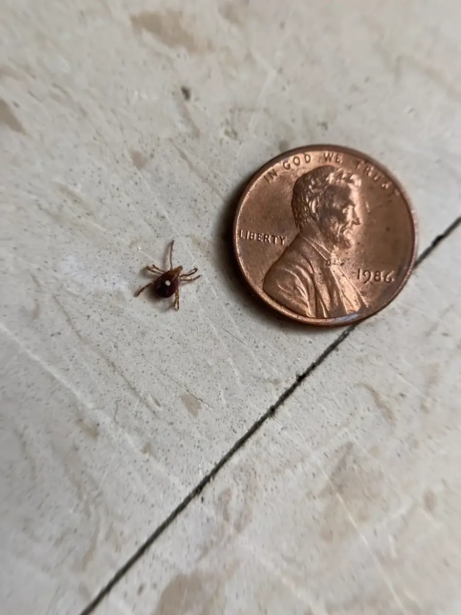
Nymphs peak. They’re smaller than adults and easy to miss on your skin.
Larvae peak. They have six legs and are tiny, so they are hard to see.
Activity tapers off as temperatures drop. Still, keep checking for ticks after time outdoors until it’s truly cold.
Why the Map Matters: Alpha-Gal and Ehrlichiosis
The reason people look up a lone star tick map is usually health. This tick is linked to a few illnesses, and where the tick lives tends to line up with where those illnesses show up. I’m not a doctor, so I’ll stick to what the CDC reports here.
Alpha-Gal Syndrome
Alpha-gal syndrome is an allergy to red meat and some other animal products. A 2023 CDC MMWR report documented 110,229 suspected cases from 2010 to 2022. Cases clustered in southern, midwestern, and mid-Atlantic counties. The report also found the highest rate of any county in Charlotte County, Virginia. It states that lone star ticks “remain the primary species associated with AGS in the United States.”
That overlap between the tick map and the alpha-gal map is no accident. The CDC says most reported U.S. cases occur in the South, East, and Central states, which are the areas where most lone star ticks are found.
Ehrlichiosis
Ehrlichiosis is a bacterial illness that lone star ticks can spread. The CDC’s ehrlichiosis clinical overview says these infections occur mainly in south-central, southeastern, and mid-Atlantic states. Again, that’s the same footprint as the tick.
Also worth knowing: lone star ticks don’t spread Lyme disease. That’s the blacklegged (deer) tick, which shares much of the same range here.
Professional Tick Control in the DMV
You can’t change the map. However, you can change how many ticks live in the shady edges of your own yard. That’s where we come in.
Our tick control service targets the spots the research points to: the woods line, shaded beds, leaf litter, and brush. Tick service runs together with mosquito service, so one plan covers both. If you’re in Loudoun or elsewhere in Northern Virginia, see our Loudoun mosquito control and Northern Virginia mosquito control pages for local details.
We’ve been in business for 58 years, with over 100,000 homes served and 1,800+ reviews. All the products we use are EPA approved and have passed through our internal research team. Each one is something we’d feel comfortable using around our own homes.
Conclusion
The lone star tick map covers most of the eastern U.S., and the range keeps creeping north. In Virginia, Maryland, and DC, this tick is a normal part of the outdoors. Still, the map only tells you the tick is in your region. What’s in your yard depends on shade, brush, leaf litter, and deer.
If you’re finding ticks around your home, or you just want to know what’s out there, we’re happy to help. Give us a call at 703-683-2000 or email info@bettertermite.com for questions or a free estimate.